Survey Products
C4Gnet.XYZ provides fast, reliable, cost-effective access to industry-standard network RTK, empowering survey professionals across Louisiana to work with greater accuracy and efficiency. Subscribe today for seamless, high-precision positioning statewide!
Louisiana's Statewide Real-Time GNSS Network for Precise Positioning
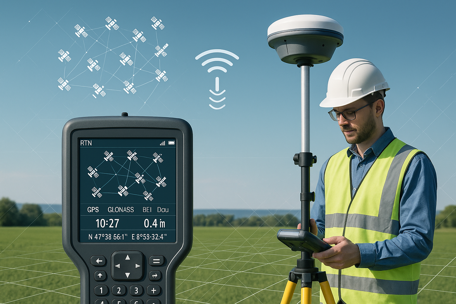
Operated by the LSU Center for GeoInformatics (C4G), C4Gnet.XYZ is a professional-grade Real-Time Network (RTN) delivering centimeter-level accurate Real-Time Kinematic (RTK) corrections across the entire state of Louisiana. Subscribers achieve high-precision GNSS positioning without setting up or maintaining a local base station.
Key Benefits
-
Exceptional Accuracy — Typically centimeter-level (within the 3D volume of a golf ball in real time), directly tied to the National Spatial Reference System (NSRS) using NAD83(2011) Epoch 2010.00.
- True Mobility — Reliable real-time corrections via cellular internet (NTRIP protocol). No base station required—faster setups, less equipment, and greater field efficiency.
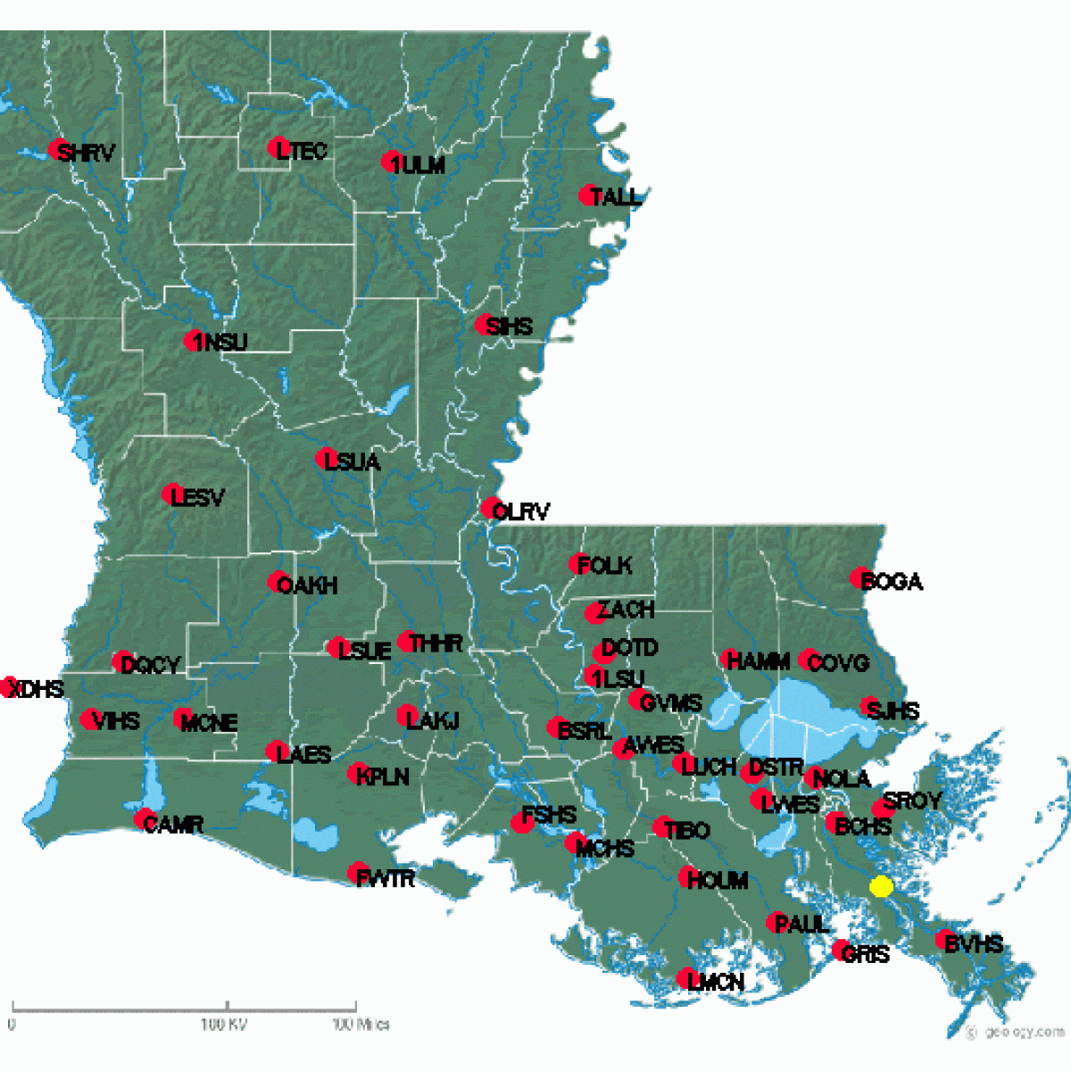
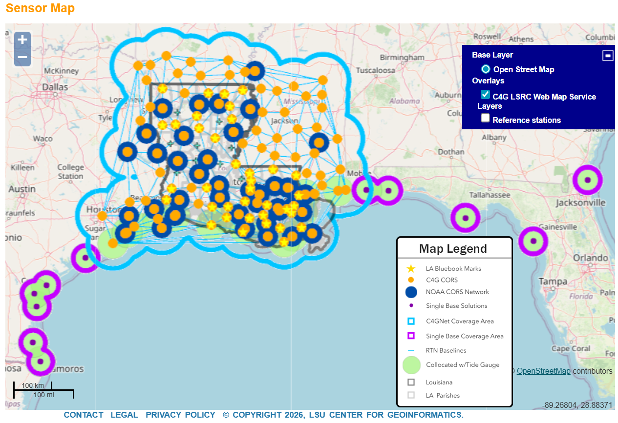
- Statewide Coverage — Powered by a dense network of over 137 Continuously Operating Reference Stations (CORS).
Wide Range of Applications
Ideal for:
- Land surveying (design/stakeout, topographic surveys, boundary/right-of-way determination, project control, photogrammetric ground control, and more…)
- Construction and monitoring
- Asset inventory
- GNSS surveying
- Mobile mapping
- Precision agriculture
- GIS data collection
- Emerging uses like autonomous vehicles
Advanced GPS/GNSS Processing Technology
-
Virtual Reference Station (VRS): Uses a network of fixed GNSS (Global Navigation Satellite System) reference stations and a central server to create a "virtual" base station near a user's rover, and by modeling atmospheric and other errors for consistent high accuracy positions, delivering real-time, centimeter-level positioning corrections via the internet, eliminating the need for a physical base station.
- Point Positioning (PPP) using RTXNet Processors: Integrates with proprietary RTX (Real-Time eXtended), a Trimble RTX technology for enhanced reliability, multi-constellation support (GPS, GLONASS, Galileo, BeiDou), and robust performance in challenging conditions.
Subscription and Access
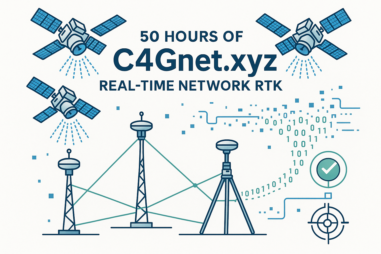
Flexible plans tailored to your surveying and advanced positioning workflow needs, including 10-hour, 50-hour, and unlimited real-time rover access and 1-second raw RINEX data for kinematic post-processing.
- Subscribe easily through the official C4G Web Store: https://store.c4g.lsu.edu/
- Manage your account and configure NTRIP at the portal: https://c4gnet.xyz/
- View network status on the Sensor Map: http://c4gnet.xyz/Map/SensorMap.aspx
- Additional resources: https://c4g.lsu.edu/